Snow Forecast for Ireland – Met Éireann’s Latest Outlook
Ireland experiences snowfall irregularly, with winter conditions varying considerably from year to year. The country’s position on the western edge of Europe means Atlantic weather systems often bring rain rather than snow, though Arctic airmasses can occasionally deliver significant winter precipitation to southern and western regions.
Understanding snow forecasts for Ireland requires examining official meteorological data and historical patterns. Met Éireann, the national meteorological service, provides the most reliable information through its forecasting platform and mobile application. The winter of 2024/25 demonstrated the variability of Irish winters, featuring above-average temperatures overall but with brief periods of significant snowfall in early January.
For those seeking current snow conditions and predictions, official sources remain the most dependable option. The Met Éireann app offers interactive animated maps showing rainfall radar, temperature patterns, wind conditions, and active weather warnings including snow and ice alerts for up to seven days ahead.
What Is the Current Snow Forecast for Ireland?
Based on the most recent extended-range forecasts available, no snow signals are present for the coming period. Current outlooks indicate a shift toward milder conditions, with temperatures expected to remain above seasonal averages through April and into May. The spring forecast suggests rainfall patterns near the long-term average, with mixed wet and dry spells rather than the cold, settled conditions needed for widespread snowfall.
National Snow Probability
Low
Expected Accumulation
Not forecast
Affected Regions
None currently
Forecast Period
April–May 2026
Key insights from current forecast data:
- Temperatures trending 0.2–1.0°C above average for April–May–June
- No Arctic airmass patterns detected in extended-range models
- Atlantic weather systems maintaining mild, unsettled conditions
- Seasonal forecast skill remains limited beyond two weeks
- Met Éireann app provides real-time updates and interactive maps
- Historical data shows snow likelihood decreases significantly after February
- Regional variations can occur even during mild winters
| Region | Snow Chance | Accumulation | Timing |
|---|---|---|---|
| Dublin | Very low | Not forecast | N/A |
| Cork | Very low | Not forecast | N/A |
| Galway | Very low | Not forecast | N/A |
| South Midlands | Low | Minimal if any | Uncertain |
| Southwest | Low | Minimal if any | Uncertain |
| West | Low | Minimal if any | Uncertain |
Will It Snow in Ireland This Week?
The week-by-week forecast shows no indication of snowfall across Ireland for the near-term period. Week one of the current outlook (covering mid-April 2026) presents mixed conditions with near-average temperatures and slightly above-normal rainfall. This pattern reflects Atlantic influence rather than the cold continental or Arctic air masses required for snow formation.
Looking further ahead, subsequent weeks trend toward drier and more settled conditions with temperatures remaining above seasonal norms. The transition into May follows a similar pattern, with no signals for wintry precipitation. These extended-range forecasts carry inherent uncertainty, but the consensus among available models points toward continued mild conditions.
Factors Influencing Snow Possibility
Snow formation in Ireland depends on specific atmospheric conditions. Cold air from the Arctic or continental Europe must meet moisture from the Atlantic or Mediterranean, and temperatures at ground level must remain cold enough for precipitation to fall as snow rather than rain or sleet. The jet stream position plays a crucial role, as it determines which air masses reach Irish shores.
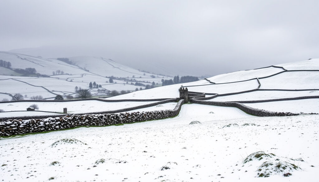
When an Arctic airmass does reach Ireland, southern and western regions—particularly the south Midlands, South, Southwest, and West—tend to experience the most significant snowfall. This pattern was observed in early January during winter 2024/25, when heavy snow remained on the ground for several days in these areas. Nine weather stations reported an “icing day” on January 8th of that period.
Extended-range forecasts beyond ten days have inherently low predictive skill. While these outlooks indicate general trends, day-to-day weather can deviate significantly. The official Met Éireann app provides hourly and daily forecasts with substantially higher accuracy for the immediate period.
Are There Snow Warnings or Alerts for Ireland?
Current monitoring shows no active snow warnings for Dublin, Cork, or Galway, nor for any other region of Ireland. The national snow and ice alert system operates through Met Éireann’s warning service and mobile application, allowing users to check real-time national alerts at any time.
During the winter of 2024/25, Met Éireann issued specific advisories related to winter conditions in January when the cold Arctic airmass brought significant snowfall to southern and western regions. These warnings covered areas including the south Midlands, South, Southwest, and West. However, no equivalent warnings were in effect for the major urban centres of Dublin, Cork, or Galway during that event.
Storm systems such as Storm Darragh in early December and Storm Éowyn in late January brought notable weather disruptions during the 2024/25 winter. Storm Darragh (December 6–7) delivered strong winds but no significant snowfall. Storm Éowyn (January 24) caused extreme wind conditions and widespread disruption across multiple counties without producing snow. This illustrates how storms affecting Ireland typically bring rain or wind rather than wintry precipitation.
What Are the Chances and Amounts of Snow Expected?
Detailed snow accumulation totals, probability percentages, and comprehensive snow maps for Ireland are not currently available from official sources. Met Éireann’s climate statement for winter 2024/25 documents temperature, rainfall, and frost occurrences but does not include detailed snowfall maps or accumulation measurements. Wind roses are available for specific locations including Dublin and Mace Head in Galway.
The Met Éireann mobile application provides high-resolution forecast maps that can help identify potential snowfall areas when conditions become favourable. These interactive tools display temperature, wind, pressure, and precipitation patterns up to seven days ahead. Users should monitor for updates when cold snaps are forecast.
The winter of 2024/25 demonstrated that when significant snow does occur, it tends to concentrate in specific regions rather than affecting the entire country uniformly. Historical records show that Athenry in County Galway experienced particularly cold conditions with 28 air frost days during that winter, yet no widespread snow was explicitly documented for Galway city itself. Meanwhile, other regions received notable snowfall.
Understanding Forecast Uncertainty
Probability-based snow forecasts require substantial atmospheric instability to generate meaningful percentage breakdowns. During stable, mild periods—similar to conditions currently forecast—there is no meaningful probability to assign. The absence of snow signals in extended-range forecasts indicates that conditions remain unfavorable for winter precipitation.
Seasonal outlooks from meteorological services indicate that temperatures are expected to remain 0.2 to 1.0 degrees Celsius above average through the April–May–June period. Rainfall forecasts suggest near-average precipitation with mixed wet and dry spells. Neither the temperature nor precipitation patterns support significant snowfall probability at this time.
Regional Snow Forecasts and Maps for Ireland
Interactive forecast maps and regional data are accessible through official channels rather than being consolidated in any single public-facing document. The Met Éireann app provides animated maps showing rainfall radar, temperature fields, wind patterns, and atmospheric pressure across the country for up to seven days ahead.
Met Éireann’s official climate statement for winter 2024/25 does not include detailed snowfall maps or regional accumulation totals. While wind roses are published for Dublin and Mace Head, comprehensive snow distribution maps are not part of the standard climate reporting. Users seeking regional snow probability data should consult real-time forecast tools directly.
Regional variations during the 2024/25 winter illustrated how precipitation distribution differed across Ireland. Rainfall ranged from notably dry conditions in some areas—Athenry in County Galway recorded just 67% of its long-term average rainfall—to wetter conditions in southern coastal regions. Roches Point in County Cork received 127% of its long-term average, demonstrating the contrast between eastern/drier and western/wetter conditions.
Where Snow Is Most Likely
Historical patterns indicate that when Arctic airmasses reach Ireland, certain regions experience more significant snowfall than others. The south Midlands, South, Southwest, and West show greater susceptibility to accumulating snow during cold events. Higher elevations within these regions also tend to receive more persistent snowfall.
Northern areas generally receive less snowfall than southern and western regions during these events, though no part of Ireland is entirely immune to winter precipitation. Dublin, situated on the east coast, tends to experience milder temperatures during cold spells due to exposure to maritime air masses, which often results in rain rather than snow in the capital.
Winter 2024/25: A Retrospective Timeline
The most recent complete winter data available provides context for understanding Irish snowfall patterns. Winter 2024/25 ranked as the 15th warmest since 1900, with a national average temperature of 6.73 degrees Celsius—0.73 degrees above the 1991–2020 long-term average. Despite the mild overall character, specific events brought notable winter conditions.
- December 6–7, 2024: Storm Darragh brought strong winds and significant disruption across Ireland. No snowfall was documented during this event.
- December 17, 2024: Highest maximum temperature recorded at Shannon Airport, reaching 15.0 degrees Celsius—demonstrating the mild, unsettled Atlantic pattern dominating early winter.
- Early January 2025: Cold Arctic airmass reached Ireland, bringing heavy snowfall to southern and western regions. Snow remained on the ground for several days in affected areas.
- January 8, 2025: Nine weather stations reported an “icing day”—a full 24-hour period with temperatures remaining at or below zero degrees Celsius.
- January 24, 2025: Storm Éowyn caused extreme wind conditions and widespread disruption. Despite the severity of this storm, no significant snowfall was associated with the event.
- January 2025: Oak Park in County Carlow recorded the lowest temperature of the winter at minus 6.7 degrees Celsius. Athenry in County Galway experienced 28 air frost days during this month.
What We Know and What Remains Unclear
| Established Information | Uncertain or Unavailable |
|---|---|
| Winter 2024/25 was mild overall (15th warmest since 1900) | Specific snow accumulation amounts for individual counties |
| Heavy snow occurred in early January in south/southwest/west regions | Detailed probability breakdowns for future snow events |
| No active snow warnings currently in effect | Precise timing of any potential future cold snaps |
| Current extended forecasts show no snow signals | Comprehensive snowfall maps for all regions |
The extended-range forecast for April through June 2026 presents a clear picture of mild, predominantly dry conditions across Ireland. With temperatures expected to remain between 0.2 and 1.0 degrees Celsius above average and rainfall near seasonal norms, the meteorological indicators do not support significant snowfall during this period. This aligns with historical patterns showing that snow becomes increasingly unlikely as spring progresses.
The Met Éireann mobile application remains the most reliable resource for monitoring developing conditions, offering high-resolution forecasts and interactive maps that provide detailed regional information. Users seeking to stay informed about potential weather changes should check this official tool directly, particularly when seasonal transitions occur and forecast confidence decreases. Those interested in practical preparation measures may find relevant guidance in resources covering essential supplies and safety considerations during adverse weather events.
Frequently Asked Questions
How accurate are long-range snow forecasts for Ireland?
Extended-range forecasts beyond ten days have inherently low predictive skill. Current seasonal outlooks indicate general temperature and precipitation trends but cannot reliably predict snowfall occurrence or amounts.
Which parts of Ireland are most likely to get snow?
Southern and western regions—particularly the south Midlands, South, Southwest, and West—show greater susceptibility to accumulating snow when cold Arctic air reaches Ireland.
Does Dublin typically get snow?
Dublin experiences less frequent and significant snowfall compared to southern and western regions. The capital’s east coast position often results in milder temperatures during cold snaps, converting precipitation to rain rather than snow.
How can I check for current snow warnings in Ireland?
The Met Éireann app provides real-time national snow and ice alerts, interactive animated maps, and high-resolution forecast data for up to seven days ahead.
What was winter 2024/25 like in Ireland?
Winter 2024/25 ranked as the 15th warmest since 1900, with above-average temperatures overall. Significant snowfall occurred in early January affecting southern and western regions, though conditions remained mild for most of the season.
Are there detailed snow maps available for Ireland?
Met Éireann’s official climate statements do not include detailed snowfall maps or regional accumulation totals. Interactive forecast tools on the Met Éireann app provide the most current mapping data for precipitation and temperature patterns.
When is Ireland most likely to experience snow?
Snow most commonly occurs during January and February in Ireland, when cold Arctic or continental air masses are most likely to reach the country. The probability of significant snowfall decreases substantially as spring approaches.
More related posts
 All Purpose Flour Same as Plain Flour: Are They Identical?
 Niall Boylan Night Time Podcasts: Schedule & Latest News
 Man O War Pub – Classic Spot for Beers and Bites
 Directions to Dublin Airport: Bus, Car, Taxi & Parking
 Bank of Ireland Clonmel: branch details, contacts & FAQs
 Dercos Anti Dandruff Shampoo – Proven Relief for Flakes and Irritation
 800 Pounds in Euros: Current Exchange Rate & Conversion Guide
 2026 World Cup Qualifiers: Qualified Teams, Groups, Fixtures & More